Parcel Inventory Management
Structured record-keeping for land holdings; map-based visualization of your entire portfolio.
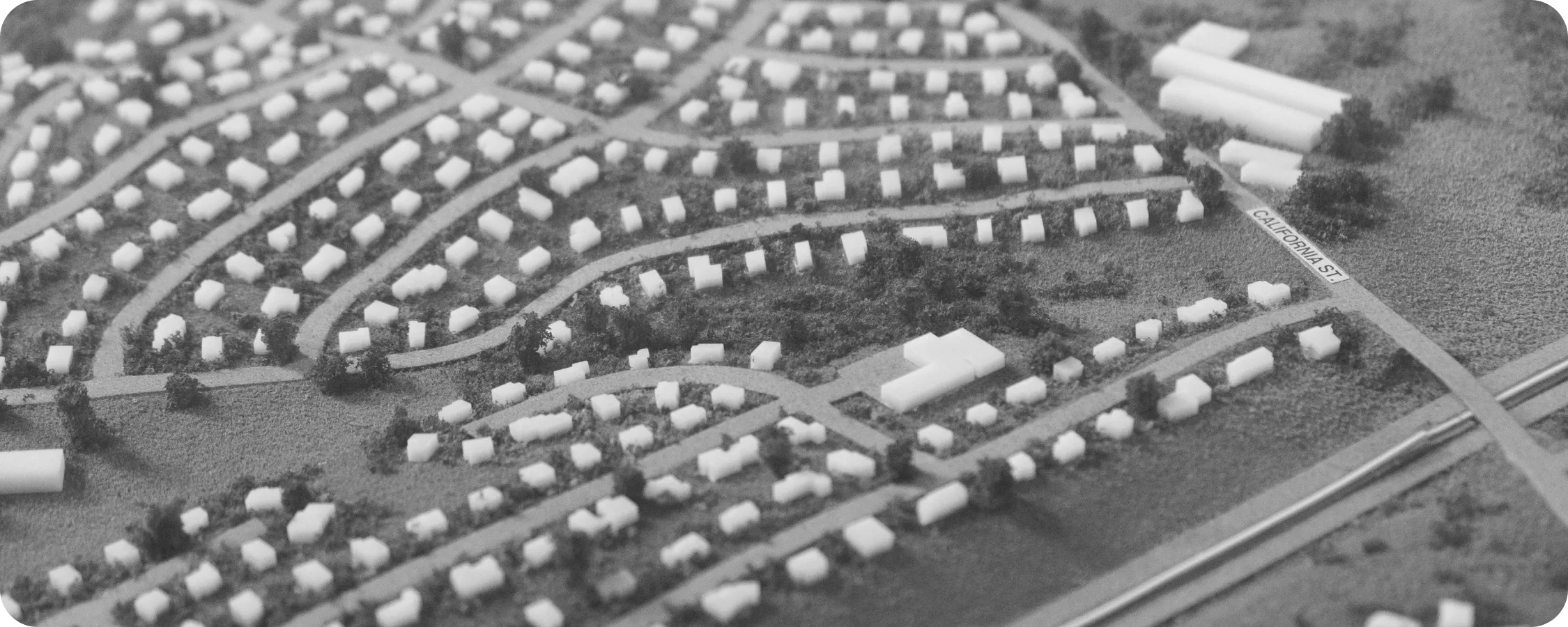
Streetscape Land simulates subdivision designs so you understand yield potential before you buy. Explore lotting patterns, street layouts, product placement. Model the economic return of every scenario.
Try It FreeSimulate subdivision designs to understand yield potential before purchase. For owned land, evaluate phase releases with optimized lotting plans.
Meet Land
Streetscape Land provides the tools to explore unlimited subdivision possibilities and make confident acquisition and phase release decisions.
Capabilities
Structured record-keeping for land holdings; map-based visualization of your entire portfolio.
Generate lotting scenarios — lot boundaries, street patterns, product placement, density configurations — in minutes.
Economic analysis of every scenario: lot count, lot dimensions, price per front foot, total projected revenue.
Evaluate simulated layouts against zoning, density, setback, and regulatory constraints automatically.
Save, annotate, and compare multiple subdivision concepts for the same parcel; track decision history.
Reads from Communities, LotWorks, municipal systems, or direct user input for parcel and constraint data.

How It Works
Load the land, simulate scenarios, and compare yield outcomes side by side.
Provide the raw parcel data: boundaries, topography, zoning, regulatory constraints. Land ingests the data and displays it in map context with all applicable development rules.
Create multiple subdivision concepts: different lotting patterns, street layouts, product mixes, density configurations. Land calculates yield for each scenario instantly with economic modeling.
Side-by-side comparison of scenarios shows yield differences, regulatory feasibility, and economic outcomes. Adjust assumptions and regenerate. Make the acquisition or phase release decision grounded in data.
Streetscape Land works within Streetscape's unified platform. One login. One workspace. All your municipal constraint data and regulatory rules ready for simulation.
Try It Free